

You can find on this page the Munich topographic map to print and to download in PDF. The Munich elevation map present the topography, river and relief of Munich in Bavaria - Germany.

The Munich topographic map shows elevation, hills and landforms in Munich. This elevation map of Munich will allow you to know topography, river and relief of Munich in Bavaria - Germany. The Munich topographic map is downloadable in PDF, printable and free.
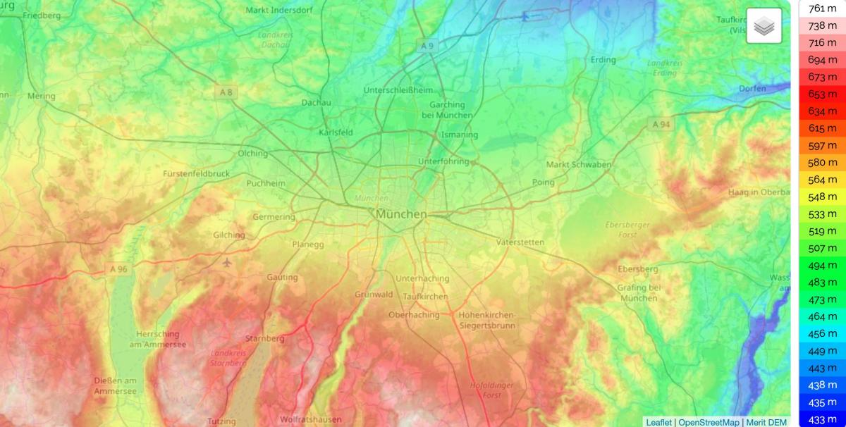
Munich lies on the elevated plains of Upper Bavaria, about 31 miles (50 km) north of the Alps, in the Northern Alpine Foreland, at an altitude of about 1,700 feet (520 elevation meters) as you can see in Munich elevation map. The northern part of this sandy plateau includes a highly fertile flint area, while the southern part is covered by morainic hills. Around Munich there are fields of fluvio-glacial out-wash. Wherever these deposits get thinner, the ground water can flood the area, leading to marshes, as in the north of Munich. The local rivers are the Isar and the Würm.
Today we feature the city of Munich, which lies on the elevated plains of Upper Bavaria, about 50 km north of the northern edge of the Alps, at an altitude of about 520 m above sea level (ASL) as its shown in Munich elevation map. The local rivers are the Isar and the Würm. Munich is situated in the Northern Alpine Foreland. The northern part of this sandy plateau includes a highly fertile flint area which is no longer affected by the folding processes found in the Alps, while the southern part is covered with morainic hills. Between these are fields of fluvio-glacial out-wash, such as around Munich. Wherever these deposits get thinner, the ground water can permeate the gravel surface and flood the area, leading to marshes as in the north of Munich.
There are 6 named mountains in Munich. The mountain of Baldehöhe is the highest elevation as its mentioned in Munich elevation map. The most prominent mountain is Fröttmaninger Berg. Baldehöhe (586m/1 923ft a.s.l.) is a mountain in Germany. The prominence is 5m/16ft as you can see in Munich elevation map. There is a trail leading to the summit.